
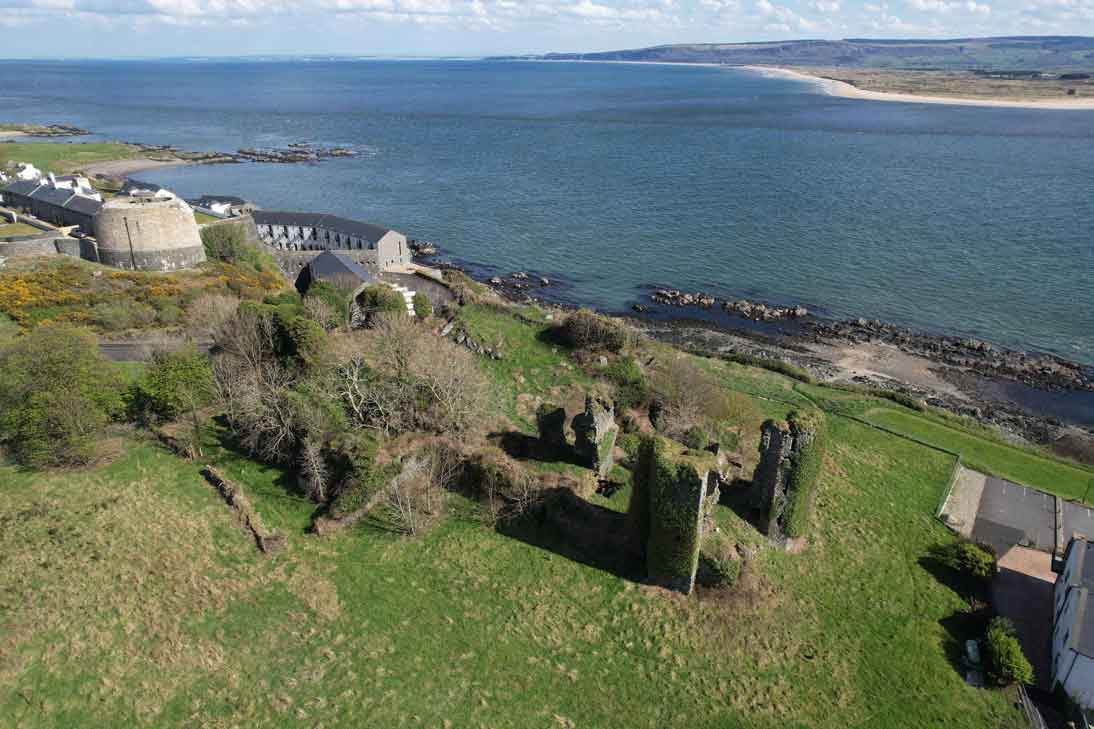
Carrickabraghy Castle was built before 1600, when it was occupied by Phelemy Brasleigh O’Doherty. Sir Cahir O’Doherty selected it as a secluded place for planning his revolt.
It does not, however, appear on early maps, and its main importance seems to date from the beginning of the 17th century, though apart from the inquisition of 1621 it is not mentioned in the records, and was apparently uninhabited in 1665. The sketch on Phillips’ Map of 1690 shows it, with unusual size and detail, as an oval bawn with seven round towers, surrounding a square keep, to the south of which is a small tower, probably belonging to a church, the place is marked on a Map of Ireland (1712).
The keep stands on a rocky outcrop on the shore, surrounded by low precipices. To the south west two ridges of rock run out for about 90 feet, and east of them is a hollow now occupied by a cottage, where perhaps the chapel stood. South-east of this hollow is a lower boss of rock, surmounted by the stump of one of the circular bawn towers, about 10 feet in internal diameter. It has walls 3 feet 9 inches thick, and remains of three musketry-loopholes.
All other traces of the bawn-fortifications have disappeared, but there seem to be foundations of a wall running east from the outer gate to the edge of the precipice, which would have divided the bawn into an outer and an inner ward. South of the bawn tower is a wide expanse of sand-hills, which may have accumulated since the 16th century, the site being at that time almost an island.


Other County Heritage Sites
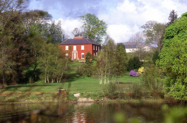
Glebe Gallery and Garden – Derek Hill House
This elegant Regency house, dating from 1828, is set in woodland gardens near the town of Letterkenny in County Donegal. The celebrated painter Derek Hill...
View Heritage Site ![]()
Greencastle (Northburgh) Castle
Greencastle (Northburgh) Ango Norman Castle was built in 1305 by the powerful Anglo-Norman Richard de Burgo, 2nd Earl of Ulster, also known as The Red...
View Heritage Site ![]()